

Services
- Air Emissions Inventories and Permitting
- Asbestos, Lead, Radon Studies
- Brownfields / Site Redevelopment
- GIS Mapping
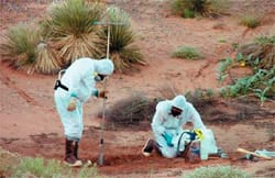
- Hazardous Materials Surveys
- Hazardous Waste Management
- Litigation Support
- Clean Air Act Compliance and Permitting
- Clean Water Act Compliance and Permitting
- Due Diligence Services for Property Transfers
- Environmental Due Diligence Audits (EDDA)
- Hazardous Spill Response Prevention Plans (SPCC), Planning and Training
- Human Health and Ecological Risk Assessments
- Mold and Biological Contaminants Studies / Cleanup
- Phase I and II Environmental Site Assessments
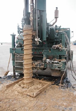
- Remedial Investigation/ Feasibility Study
- Remedial System Designs, Installation, Operations and Maintenance
- Risk Assessments
- Spill Response
- Soil, Water and Wastewater Sampling
- Stormwater Pollution Prevention Plans (SWPPP)
- Post-closure Long-term Landfill Gas and Groundwater Monitoring
Example Projects
- Asbestos Inspection and O&M Planning – USFWS Wildlife Refuges, NM, AZ, and TX
- Downtown Brownfield Investigations – Waterloo, IA
- Environmental Base Operations Support – White Sands Missile Range, NM; Yuma Proving Ground, Yuma, AZ; and Ft. Huachuca, AZ
- Environmental Compliance and Engineering Support – Playas Training Center, NM
- FAA Aerial Tramway Replacement Environmental Due Diligence Audits – El Paso, TX
- Hearst Mill Site, Brownfields Project – Silver City, NM
- Crude Storage and Blending Facility Remediation – ND
- Peru Hill Mill, Brownfield Site – Deming, NM
Services
- Categorical Exclusions
- Environmental Assessments
- Environmental Impact Statements
- Environmental Impact Document
- Army Sustainable Range Program
- Range and Training Land Assessments (RTLA)
- Land Integrated Training Area Management Plans (ITAM)
- Land and Rehabilitation Management (LRAM)
- Biological Resources Surveys
- GIS Mapping and Geospatial Database Development and Management
- Natural Resources Conservation Services (NRCS) Rangeland Data Collection, Natural Resources Inventory (NRI)
- Non-native Plant Herbicide Spray Service
- Section 7 Endangered Species Act – Consultation
- Trail Remediation and Designs
- Wetland delineation and planning
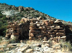
- Archaeological Field Surveys (Class III)
- Archival Research
- Cell Tower FAA 620/621
- Surveys Cultural Resources Monitoring
- Ethnographic and Oral History
- Historical Building Surveys
- Linear Project Routing and Siting Studies
- National Register of Historic Places
- Site Documentation
- Eligibility Recommendations
- Nomination Forms
- Remote Sensing
- Section 106/110 of National Historic Preservation Act Consultation
- Testing and Data Recovery (excavation) Projects
Example Projects
- City of Las Cruces Safety Complex and Recreation Facility Environmental Assessment, Biological, Cultural, and Paleontological Surveys, Phase 1 Environmental Site Assessment, Public Coordination, and Cultural Sites Mitigation – Las Cruces, NM
- FAA Aerial Tramway Replacement Environmental Assessment – El Paso, TX
- Alamogordo Wastewater Treatment Facility Environmental Information Document, Biological and Cultural Resources Surveys, and Public Coordination – Alamogordo, NM
- Environmental Support Services – Fort Huachuca, AZ
- Village of Ruidoso, Environmental Assessment, Biological and Cultural Resources Surveys, Wetland Delineation and Corps of Engineers 404 / 401 Permitting – Ruidoso , NM
- BASCOR 30-acre Landfill Transfer Environmental Assessment and Biological Assessment – Truth or Consequences, NM
- NRCS/Natural Resource and Rangeland Inventory Monitoring Surveys
- NRCS Data Collection and Geospatial Data Management – NM
- Sustainable Range Integrated Training Area Management, Range and Training Land Assessment – Fort Huachuca, AZ
- Environmental Support Services – ATEC – WSMR, NM
- Environmental Support Services – Garrison – WSMR, NM
- Critical Habitat Management for Huachuca Water Umbel Chemical Treatment for Invasive Plants – Fort Huachuca, AZ
- Invasive Plant Species Control of the African Rue – Fort Bliss, NM
- Natural Resource Survey and Preservation of Solar Array Project – Holloman Air Force Base, NM
- Location Studies for the NM Endangered Night-blooming Cereus – Fort Bliss, NM
- AT&T, Cultural resources survey and testing for a 23-mile fiber optics line – Las Cruces, NM
- New Mexico Spaceport Authority, Cultural resources survey (3000 acres) and data recovery of four NRHP significant entrance road sites for Spaceport America – Truth or Consequences, NM
- US Bureau of Reclamation Damage Assessment of a Prehistoric Mogollon/Mimbres Habitation – Sierra County, NM
- US Army Corps, River Ranch historical documentation survey – Santa Rosa, NM
- US Army Corps, Labadie and Puerto de Luna historic acequia survey and oral history survey – Santa Rosa, NM
- Yuma Proving Ground, historical research and archaeological survey of 1,800 acre WWII era Camp Laguna – Yuma, AZ
- White Sands Missile Range, Excavation of Lizard Village, Ceramic period pit house dwellings – Las Cruces, NM
- Holloman Air Force Base, Cultural resources survey of 800 acres for photovoltaic facility – Alamogordo, NM
Services
- 40-Year Water Planning
- Annual Consumer Confidence Reports
- Baseline Monitoring Reports
- Grants Funding Support
- Hydrologic Analysis
- Industrial Pre-treatment Programs Sampling and Reporting
- Industrial Wastewater Permitting and Treatment
- Irrigation System Designs
- Life-cycle and Cost Analysis and Estimating
- Network Analysis for Water Distribution Systems
- Preliminary Engineering Reports
- Master Planning
- Slug Control Plans
- System Rate Studies
- Solvent Management Plans
- Water Rights
- Water and Wastewater Systems Design and Permitting
- Water and Wastewater Monitoring, Laboratory Analysis, and Reporting

Example Projects
- 40-year Water Resources Master Plan – Chaparral, NM
- Industrial Pre-treatment Programs Sampling – Various Locations, NM
- Lower Rio Grande Water Users Association Regional 40-year Water Plan – Southern Doña Ana County
- Playas Training Center Wastewater Lagoon’s Improvements – Playas, NM
- Potable Water Sampling – Fort Huachuca, AZ and Playas, NM
- Septic Regulations Development – Luna County, NM
- Wastewater System Upgrades, BECC – Bisbee, AZ
- Wastewater Sampling – Fort Bliss, TX and Fort Huachuca, AZ
- Wastewater Upgrades, BECC/EPA – Nogales, AZ and Mexico
- Water and Wastewater Master Plan – Fort Bliss, TX
- West Pipeline Project, Feasibility Study – Del Rey to El Paso TX
Services
- Surface Hydrologic (Stormwater Runoff) Analysis, Management, and Design
- Hydraulic Systems Analysis and Design
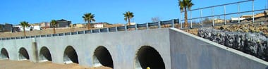
- Bridge and Culvert Systems Scour Analysis
- River and Channel Analysis and Design
- MS4 and Storm Sewer Analysis, Design, and Inspection
- Retention and Detention Pond Analysis and Design
- SWPPP Preparation, Implementation, and Inspection
- Floodplain Management, FEMA Flood Insurance Rate Studies, and CLOMR /LOMR Package Applications
- Dam Systems Design and Performance Analysis
Example Projects
- Bridge and Channel Replacement Design, Hydrologic and Hydraulic Analysis and Design, Clean Water Act Permitting, and Construction Management of Ten Bridges – Village of Ruidoso, NM
- Use Attainability Analysis (UAA) of the South Fork Arroyo – City of Las Cruces, NM
- Petaluma River Flood Analysis – Petaluma, CA
- Nafzinger Arroyo, CLOMR – Las Cruces, NM
- Santo Domingo and San Felipe Pueblos Bridge Analysis – NM
- Stormwater Master Plan Study – City of Las Cruces, NM
- Bridge Replacement Projects – Navajo Nation, NM and AZ
- Hippie Fire / Cibola NWR Watershed Design – CA
- CertainTeed Gypsum Pond Systems Upgrades – Nashville, AR
- Sandhill Arroyo System, CLOMR, Arroyo Design – Las Cruces, NM
- Drainage Analysis, Stewarts Point Rancheria – Santa Rosa, CA
- Peach Orchard Draw Drainage Analysis – Zuni, NM
- XL Ranch Reservation Bridge Replacement Project – Modoc County, CA
Services
- Authority to Construct Applications
- Construction Permit Applications
- Emissions Dispersion Modeling
- Emission Inventories
- Emission Reduction Credits
- Indoor Air Quality Sampling and Analysis
- New Source Performance Standards OOOOa
- Notice of Violation and Compliance Support
- Opacity Monitoring
- Permit Condition Tracking
- Title V Permit Applications
- Visibility Impacts Analysis
Example Projects
- Air Permitting and Environmental Compliance Services, North America BPB Gypsum Co.
- Air Emissions Inventories, Title V Permit Compliance and Air Permitting, WSMR, NM
- Campbell Substation Air Permitting and Air Emissions Controls Analysis, Las Vegas, NV, Las Vegas Valley Water District
- Air Emissions Construction Permit, Frontier Energy Natural Gas Plant, Maljamar, NM
- Lone Mountain Aggregate Operations / Las Vegas, NV
- Calpine Energy 560 MW Natural Gas Fired Power Facility, Dona Ana County, NM
- CertainTeed Gypsum Wallboard Plant, Nashville, Arkansas Air Construction permit and Title V permit modifications
- Nevada Cogeneration Associates / Air Emission Permitting For Proposed Peaker Plant Installations, Clark County, NV
- PABCO Gypsum Company – Air Permitting Analysis For Plant and Mine Expansions / Clark County, NV
- Calpine Energy 585 MW Natural Gas Fired Power Facility, Turner, OR
- Kayenta Coal Fired Power Project Feasibility Analysis, AZ
- CertainTeed Industries Jacksonville, FL Air Emissions Inventories and Air Emissions Compliance
Services
- New Site Development and Remodel Design
- Demolition
- Layout
- Grading and Drainage
- Utilities
- Construction Phasing
- Erosion and Sedimentation Control
- Drainage Report
- SWPPP
- TIAs
- Storm Analysis, Mitigation Design, and Permitting
- Hydrology / Hydraulic Systems
- Secondary Containment Systems
- Industrial Wastewater Pre-treatment
- Landfills / Solid Waste Facilities
- Water and Wastewater Systems and Utilities Services and Systems
- Roadway and Highway Design
- Master Plan
- Preliminary Plat, Final Plat, and Construction Documents
- Preliminary Engineering Reports
Example Projects
- Bridge and Road Design and Construction Management of multiple bridges – Ruidoso, NM
- Tularosa Elementary Parking Lot – Tularosa, NM
- Downtown Plaza, City of Las Cruces – Las Cruces, NM
- Marketplace at Sonoma Ranch, Williams Design Group – Las Cruces, NM
- Master Planning, Preliminary Plat and Civil Design of 1051-acre Industrial Park development in Santa Teresa, NM
- Site Design-Construction Drawings Walmart Stores, Academy Road – Albuquerque, NM
- Site Design Development Plan, Wal-Mart Stores, Valencia & Alvernon – Tucson AZ
- Schools in Southern NM for Several School Districts (Las Cruces, Deming, Tularosa, Alamogordo, Anthony, Berino, Central, Arrey, and Bayard)
- Duke Energy Power Facility, Evaporation Ponds Design – Luna County, NM
- Clipper power Roadways and Pad Areas – Needles, CA
Services
- Natural Resource Management, Analysis, and Surveys
- Habitat and Risk Identification
- Spatial / Environmental Data Management Systems
- Online Interactive Maps for Organizations
- Suitable Locations Analysis
- Hydrological and Watershed Analysis
- Adding Elevation Values to Existing Spatial Data
- Spatial Interpolation of Data Values Based on Samples
- Classifying Land Use from Satellite Imagery
- Line of Sight / View Analysis
- Basic Groundwater Contaminant Dispersion Modeling
- Classic Mapping
Example Projects
- Range and Training Land Assessments (RTLA) In Support of Fort Huachuca Sustainable Range Integrated Training Areas Management (ITAM) Program – Sierra Vista, AZ
- Geospatial assessments of site conditions – erosion, compaction, vegetation loss , etc. – entered into SDSFIE 3.1 standard geodatabases.
- Natural Resources Support – Fort Bliss, TX
- $3.5 million contract including biological and field surveys of terrestrial and aquatic systems; development of GIS analysis and diagrams of the occurrence and absence of biological species in relation to existing data sets; habitat analyses; management and compliance support for threatened and endangered species, or other sensitive species; and wildlife management support.
- Sampling, monitoring and analysis of restoration sites – White Sands Missile Range, NM
- Collection & inventory of data into an enterprise database that provides the foundation for the environmental data management system (EDMS) which is a web-based environmental information and retrieval program written and maintained by Zia.